Technical Reports
Red Rock Canyon Gold Project IP Report | Sub Rosa Monitoring LLC
Sub Rosa Monitoring LLC performed a resistivity and induced polarization (IP) survey over a small grid within the Redrock Canyon site located approximately 5 miles southeast of Tombstone, Arizona, July 24 – 30, 2025. The survey was conducted over an area previously tested with drilling. “The primary purpose of the survey was to determine the correlation, if any, between the areas of known gold mineralization and the electrical geophysics.”
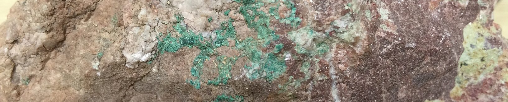
“Survey results were compared to drillholes with assay data…. A good correlation between both resistivity and IP with the jasperoidal veining, associated sulfides and gold assays in the drillholes was confirmed. The veins produced diagnostic signatures that were readily traceable to specific locations. The combination of mineralized veins and diffuse mineralization within the adjacent limestones provided easily identifiable drilling targets. The results of the survey provide confirmation that the known gold mineralization, previously determined from geochemistry and drilling, was readily manifested in the geophysical data. Structural features, either mineralized or not, and their orientations were detected and mapped by the electrical geophysics.” (Liberty Star Minerals Redrock Canyon IP and Resistivity Field Survey, p.3)
Independent Evaluation|James Bryce B.Sc. CP,Consulting Geologist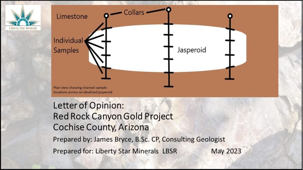
The Red Rock Canyon target consists of 6,653 acres of Arizona MEPs and 320 acres of unpatented Federal Lode Mining Claims. The area has been segregated from the larger Hay Mountain Project block after the examination of jasperoids bodies that displayed gold values. In the Technical Report:
- Compilation of previous drilling results, by others as noted in The Technical Report, indicates that 12 of 17 intercepts reported gold at grades above what is considered current cut off grades, 0.022 oz per ton (0.68 gpt).
- These historical intercepts range from five (5) to forty-five (45) feet in vertical extent and reveal multiple mineralized zones. Grades in the larger intercepts are reported up to 0.182 ounces per ton (5.66 gpt).
- In addition to three field visits (2020, 2021) tech team investigated previous findings including geochemical studies, geophysical surveys, field notes and drill logs.
- Given surface study results combined with previous drilling information, Mr. Guarnera concludes that new drilling aimed at expanding the areal extent of economic gold concentrations certainly has merit.
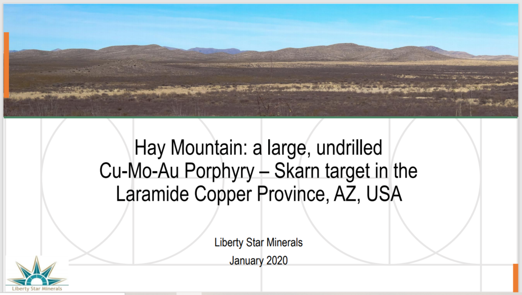
Dr. Alan Wilson’s Hay Mountain Project Presentation
Liberty Star’s 2011 technical report over the larger area.The Hay Mountain Exploration Report was compiled by SRK Consulting under Qualified Persons Corolla K. Hoag & Jan C. Rasmussen. This 195-page Canadian NI 43-101 compliant document relied on extensive field visits and detailed research of previous exploration studies of the area.
Outside Expert Source UVF Study November 2020 In late November 2020 Liberty Star received a second UVF study from an outside expert source (under confidentiality agreement) using a more powerful shortwave UVF light that utilizes a wavelength of 254 nanometers Vs 365 nanometers that was used in July on the Field Mapping 2020 collected samples completed by contract Geologist Daniel Koning. The outside higher-powered equipment verifies what Liberty Star presented in the initial offering, Hay Mountain Project July 2020 Field Mapping Report. The presentation includes the outside expert source’s map and data table, formatted according to Koning’s July 2020 data table.CA UVF Map 20201214
CA UVF Table 20201214
UVF Samples From July 2020 Field Mapping PDF 20201204
Hay Mountain Project July 2020 Field Mapping Report – Prepared by Daniel Koning, Contract Geologist From July 14th to August 5th, 2020 Geologist Daniel Koning conducted field mapping over the Hay Mountain Project. “The purpose of the mapping was to identify alteration and veining associated with an inferred porphyry copper system at depth, determine the extent of hydrothermal alteration, and comment on the possible timing of mineralization.” Dr. Alan Wilson (Hay Mountain: a large, undrilled Cu-Mo-Au Porphyry – Skarn target in the Laramide Copper Province, AZ, USA) notes,”of particular importance is the observation of increased vein intensity in outcrops surrounding the already identified targets, which suggests proximity to a large, potentially copper-bearing hydrothermal system.” Mapping was conducted at 1:10,000 scale and a total of 183 carbonate vein samples were taken for pXRP analysis and UV fluorescence response.” This report contains over 50 new field images and maps. REVIEWER DOCUMENTS_July2020_FieldMappingReport_DKoningAug16
Biogeochemistry of the Hay Mountain Project, Tombstone District, Arizona, Prepared by Dr. Pim van Geffen, Vancouver Geochemistry [Dec 2019] LSM_HyMtn_Biogeochem_v1
Pim van Geffen, PhD, PGeo – Principal Geochemist at Vancouver Geochemistry professional geochemist and consultant based in Vancouver. He obtained his PhD at Queen’s University in Kingston, Canada, and has a MSc from Utrecht University in the Netherlands. Over the past 15 years he has worked on a wide variety of projects in applied geochemistry & geochemical data analysis, ranging from soil- and biogeochemistry to lithogeochemistry and geometallurgical assessments. He currently works as an independent consultant, solving problems in geometallurgy, mineral exploration, and lithogeochemistry. Pim was previously employed as Geochemist with Anglo American, Senior Geochemist with ioGlobal, and as Manager Geosciences – North America with REFLEX. He is a registered Professional Geoscientist with Engineers and Geoscientists of British Columbia (EGBC), a member of the Technical Advisory Committee of Geoscience BC, and a fellow of the Association of Applied Geochemists.
Report on 3D ZTEM™ & 3D Magnetic Inversion Results Prepared by Jean M. Legault, Geotech Ltd. [Dec 2019] GL130168_3DZTEM_3DMVI_Interpretation_Report
Jean M. Legault is a +30 year career exploration geophysicist. He obtained his Bachelor’s degree in applied science (geophysics) at Queen’s University at Kingston, ON and his Master’s degree in applied science (geophysics) at École Polytechnique of University of Montreal, QC. He is an experienced geophysicist in both the ground and airborne geophysics sectors since 1985. He is chief geophysicist at Geotech Ltd. (Aurora), a worldwide airborne geophysical service provider, where he is mainly interested in natural field and time-domain airborne EM methods as geological mapping tools for mineral exploration.
Liberty Star Geophysical Review / Integrated 3-D Model – Prepared By Alan King, Geoscience North [Dec 2019] Corrections to the List of Figures made 02.23.2020 LibertyStarGeophysical2019_JKv4
Alan King P. Geo., M.Sc., founder Geoscience North, received a B.Sc. in geology from the University of Toronto in 1976 and an M.Sc. in geophysics from Macquarie University in 1989. He has worked as a geophysicist in exploration and resource development in Canada and Australasia. From 1990 to 2012 he was employed by Inco /Vale as a senior geophysicist and then Manager of Geophysics with responsibility for global exploration. As Chief Geophysicist for Vale Global Exploration Alan worked on geophysical applications for base metals, iron, manganese, coal and fertilizers (potash and phosphate) as well as target generation using regional and global data sets. Alan is currently working as a consultant with his own company Geoscience North. His professional interests include the use of geophysics, new technology (and ideas) and data integration in exploration, mining, environmental, geotechnical and other applications.
Historical Reports
Roger Newell’s graduate dissertation, Exploration Geology and Geochemistry of the Tombstone-Charleston Area [1974] – an early, highly illuminating study based on bio-geo-chemical analysis. Dr. Newell later reached international prominence using his analytical skills to recognize the potential of the Carlin Trend in Nevada. REVIEW_DOCUMENT USA, Arizona, Cochise County, Exploration Geology and Geochemistry of the Tombstone-Charleston Area. By Roger A Newell. December 1974
3 detailed descriptions of the Red Rock Canyon in 1989 -1990 by P.Geo Leroy Halterman among others. These data are linked through the Arizona Geological Survey’s gigantic digital archive. Also of interest is noted geologist Jonathan DuHamel’s 1989 memo found in Liberty Star’s own archive. His description concludes: “There is potential for relatively high-grade mineralization if the ‘leakage’ at the surface is any indication.” Primary Sources 20210519
J.E. Duhamel, Phelps Dodge, 1989, Memo
Forward-Looking Statements: These reports may contain forward-looking statements as defined by the U.S. Private Securities Litigation Reform Act of 1995. These statements involve risks, uncertainties, and factors beyond the Company’s control that could cause actual results to differ materially from those expressed or implied. Forward-looking statements may include projections, expectations, plans, and assumptions regarding exploration results, mineral resources, and future operations. For a detailed discussion of risk factors, refer to the Company’s Annual Report on Form 10-K and other filings with the SEC. Regulation S-K 1300 Compliance: Liberty Star is classified as an “Exploration Stage Issuer” under Subpart 1300 of Regulation S-K. The Company currently has no exploration results, mineral resources, or mineral reserves to report under this regulation. U.S. investors are cautioned not to assume that any part of the Company’s mineralized properties will be converted into measured or proven reserves.