Liberty Star Uranium & Metals Corp. (LBSR: OTCQB), d/b/a Liberty Star Minerals, is an Arizona-based mineral exploration company engaged in the acquisition, exploration, and development of mineral properties in Arizona and the southwest USA. Currently the company controls properties which are located over what management considers some of North America’s richest mineralized regions for copper, gold, silver, molybdenum (moly), and associated metals. The Company’s premiere property is Hay Mountain Holdings, LLC (exploration stage) for porphyry copper, gold, moly and other commercially important minerals. Specific targets have been selected to explore for near surface and deep-seated ore bodies, of which there are numerous analogs nearby. Contiguous with the primary Hay Mountain porphyry exploration target is an increasingly attractive area of exploration stage gold mineralization denominated Red Rock Canyon Gold Property. Red Rock Canyon exhibits what we believe are extensive, promising hydrothermal associated gold bearing structures that are documented in historical public and Company records (see associated press and social media releases for more information). Hay Mountain Holdings is in Cochise County (southeast) Arizona, USA.
Centralized oversight of all mineral assets/holdings are consolidated under Liberty Star Hay Mountain Holdings LLC. The multi-mineral claims historically known as Hay Mountain Target 1 & 2 is a wholly owned subsidiary, Earp Ridge Mines, LLC. This dedicated entity brings a sharper focus to the development of the region’s diverse mineral potential. Additional claim areas within the larger Hay Mountain Holdings LLC will be similarly organized as needed. The Company’s world-class gold target is hosted by Red Rock Mines, LLC, a wholly owned subsidiary created to advance and highlight this exceptional gold resource opportunity. American Strategic Minerals, LLC is an entity which can create partnership opportunities in critical minerals—areas with significant potential for copper, gold, rare earth elements, and other critical minerals essential to U.S. technology and defense infrastructure.
 Liberty Star Minerals maintains a presence on Facebook, Twitter (Liberty Star/LBSR) and Linkedin. From time to time Liberty Star will make material disclosure through these social media outlets in compliance with SEC Regulation FD.
Cochise County, Arizona
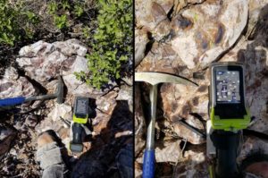
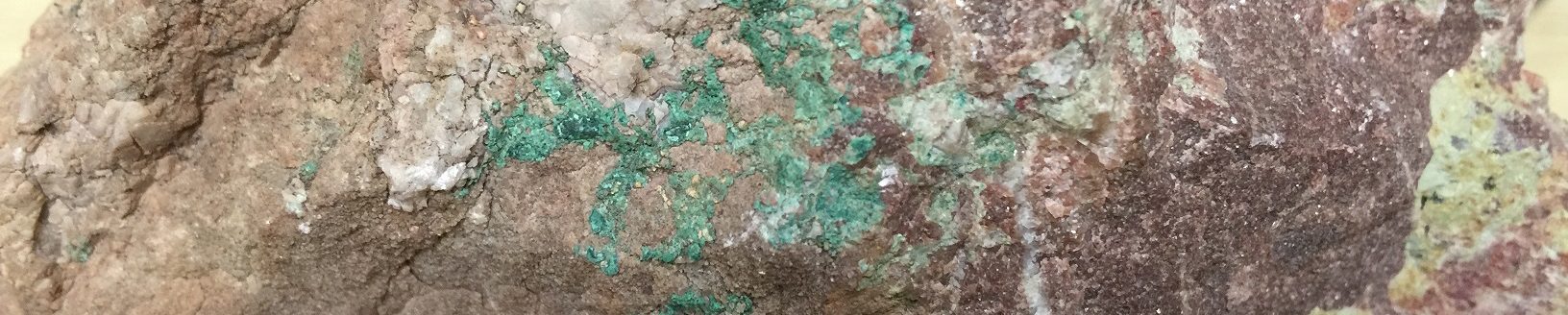
Close up jasperoids, Hay Mountain Project 2020
The Tombstone Project (TP) hosts Liberty Star’s premiere multi target property: Hay Mountain Holdings, LLC. The TP initially consisted of 33 unpatented federal lode mining claims over a projected covered porphyry copper mineral center in Cochise County, Arizona. In 2011 and 2012 more USBLM claims and Arizona Mining Exploration Permits were added after the discovery of a large multimodal anomaly over a large covered porphyry copper mineral center within the larger TP area. Currently, the TP, including Hay Mountain Holdings LLC entails a 42 square mile area of interest. The entire claim area has undergone formal review by SRK Consulting (as the Hay Mountain Project). SRK produced technical reports (technical reports per USSEC) which recommended further exploration for copper, gold, moly and other metals.
Liberty Star contracted Geotech Ltd. to run ZTEM electro magnetic surveys over the TP in 2013, starting with the Hay Mountain claim area.
Among Geotech’s findings:
- There are as many as 10 meaningful targets within the Hay Mountain area
- Hay Mountain contains a major anomaly centered on the geochem anomaly reported by Liberty Star
From the Geotech Report Executive Summary:
“The Hay Mountain Property is mainly underlain by a thick sequence of Paleozoic quartzite, limestone and siltstones, but potentially hosts buried porphyry copper deposits at structural intersections and under basin-fill formations. There is additional potential for polymetallic carbonate-hosted replacement deposits (CRD), as well as shallow chalcocite blanket porphyry type deposits and also skarn type porphyry copper deposits. Previous soil and vegetation geochemical surveys have identified a coincident Au-Pb-Cu anomaly and larger Mo-halo in the center of the property. The objective of the ZTEM surveys is to identify favourable magnetic and resistivity signatures related to potentially more deeply buried porphyry copper, CRD/skarn and chalcocite replacement deposits at Hay Mountain. The Magnetic surveys have determined that Hay Mountain hosts a large dominant magnetic high that lies buried below the Paleozoic sediments is centered over the Liberty Star geochemical anomaly and remains open to the south…As many as ten (10) magnetic anomalies have been defined.” (12/11/2013)
3D ZTEM™ & 3D Magnetic Inversion Results were prepared by Geotech in December 2019. The enhanced data can be reviewed on the Geoscientific Reports webpage.
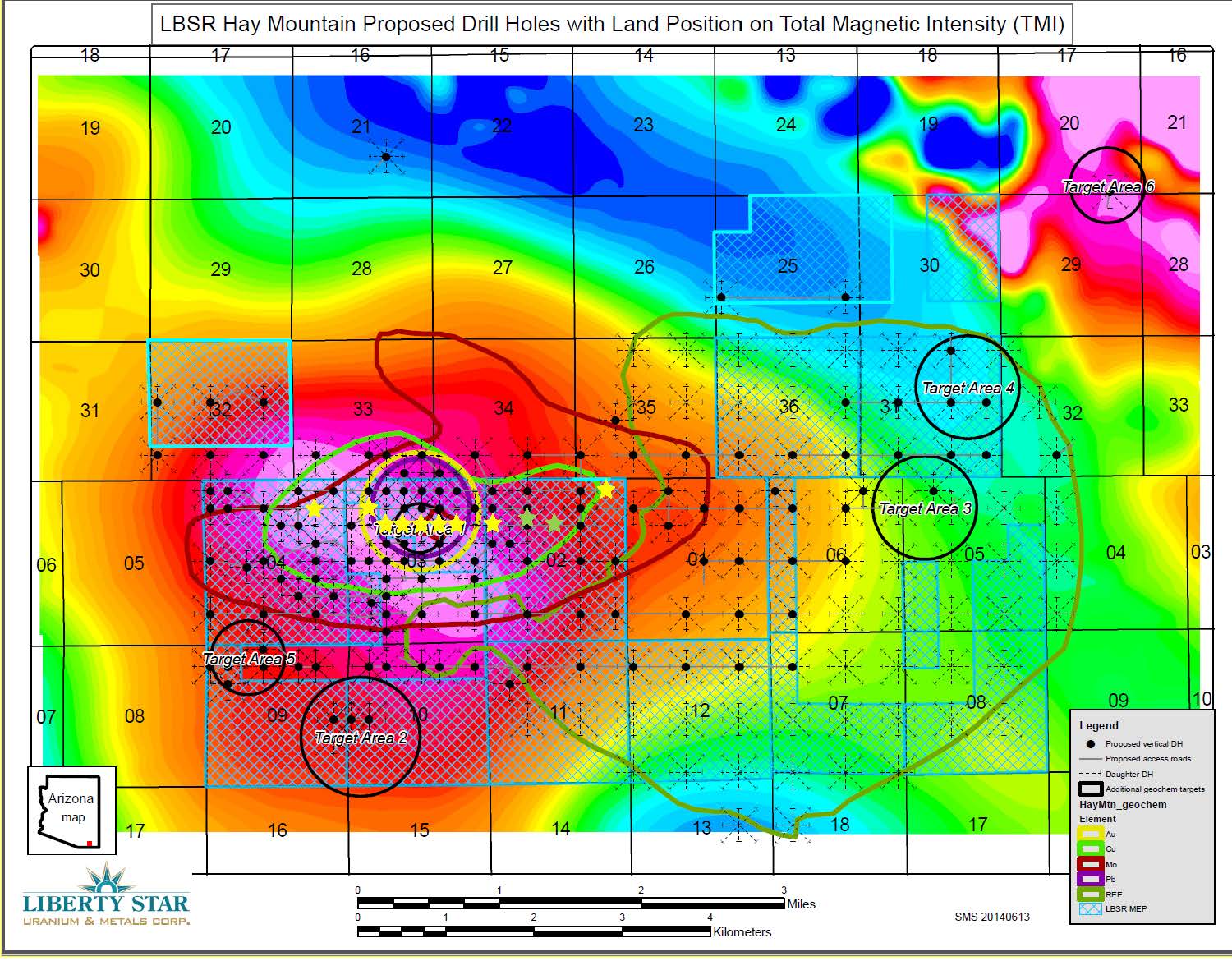
TMI with geochem map – Click on image to enlarge
Liberty Star presents in- depth geoscientific reports & geochemical assay results bringing together years of data compilation over the Hay Mountain. Ground & airborne studies indicate the potential for a large sediment and porphyry hosted copper, gold, and moly ore body of the same type as the nearby Bisbee deposit and other commercially important ore bodies throughout southeast Arizona.
Land Position
Hay Mountain Holdings is located 6.5 miles southeast of Tombstone where we hold Arizona State Mineral Exploration Permits (MEPs), and Federal Mining Lode Claims covering 16,888.42 acres, accessible by Hwy 80, Davis Rd. and Wild West Road.
The Red Rock Canyon Gold Prospect is contiguous with and immediately north of Hay Mountain Project drill Target 1 (Earp Ridge Mines, LLC).
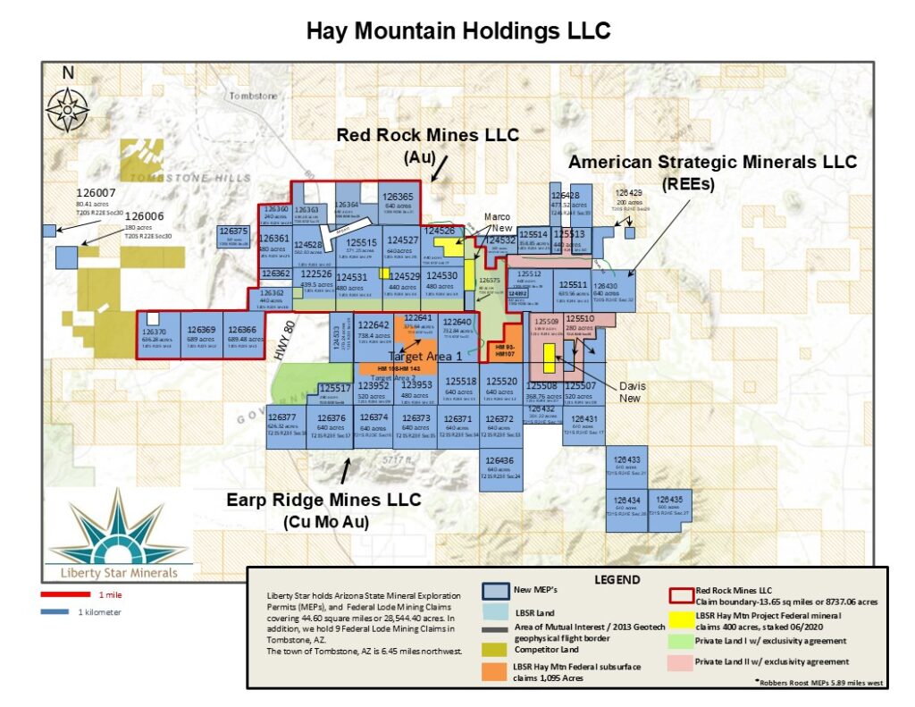
Claims / Permits Map – Click image to enlarge
Read more about The Hay Mountain Project
Images & maps
Geochem assay tables
Company news